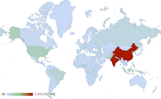
If you have data (such as world population) that you would like to instantly make into an interactive map - try using Google Sheets.
Here are the steps:
- enter data into the Sheet
- Insert > Chart
- Change the drop down chart type to either a Geo Chart or Geo Chart with markers
- You will then see the chart
- if you need to change make sure to select customize
- to change chart style choose the drop down and make your adjustments
- to change the chart (maybe from World to United States choose Geo and then region.
- you can also change the color of the minimum, medium, and maximum
- Finally, you can download the image, publish it to the web, copy, etc.
Click here to see the chart published to the web.
Embedded below is a 2 minute and 22 second YouTube tutorial.
Take care,
Brad


No comments:
Post a Comment